Maritimes - Summer 2008
July 5 - 25, 2008
Day 14 - July 18: Mira, Point Aconi, Sydney, & Geo Event: Point Aconi and the Cape Breton Coal Earthcache
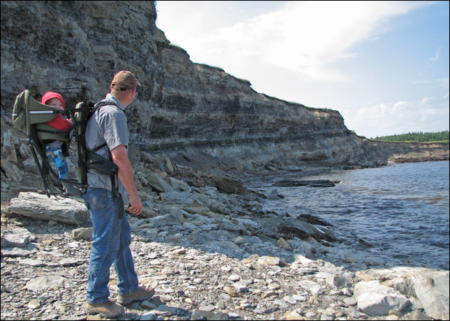
This one became a favourite cache of ours not just for the coal, the fossils and the scenery, but also because of the adventure we had getting this cache. We didn't arrive at the best time tide wise so there was no quick and easy access point down to the bottom of the cliffs. We searched a bit and finally Rubby found a spot where he managed to climb down. So off he went to fulfill the earthcache requirements. Rubby came back with a few fern fossils and amazing photos. So Rubby quickly made it down the cliff with Christopheron his back and Samantha on his shoulders.
What cool fossils! And the cliffs are amazing although we made sure to not get too close, especially with the kids, as rocks would occasionly crumble down. Finally we decided we'd better head back before the tide rose too far and Rubby headed off. Finally reached the top with a huge sigh of relief to be greeted by... a local police officer chatting with Rubby! He had come to do his rounds and was curious as to what we were up to. Rubby explained the whole concept of geocaching to him and asked him if he'd like to come find a cache. So off we went to find one of the traditionals on the site! Definitely a first for us to take a police officer geocaching!
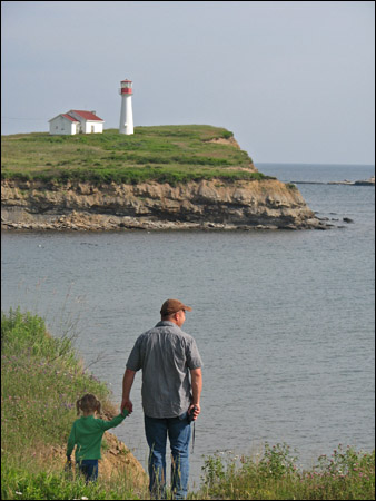
Samantha and Rubby making a quick grab before heading to Point Aconi.
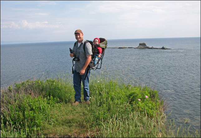
Right at the tip of point aconi.
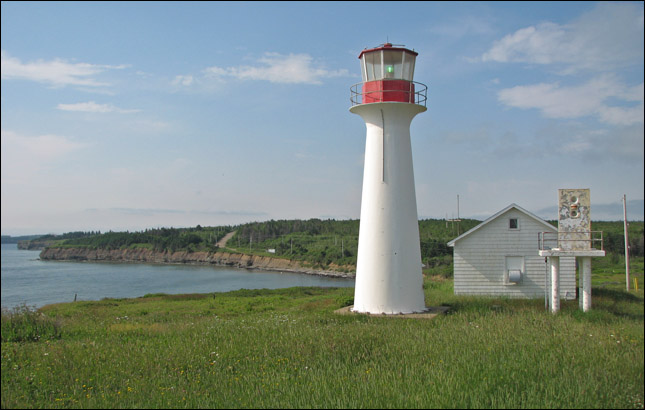
The point Aconi light house.
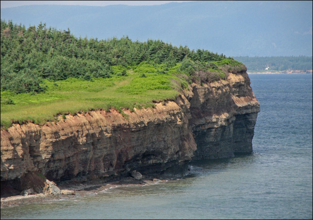
The view back from the point.
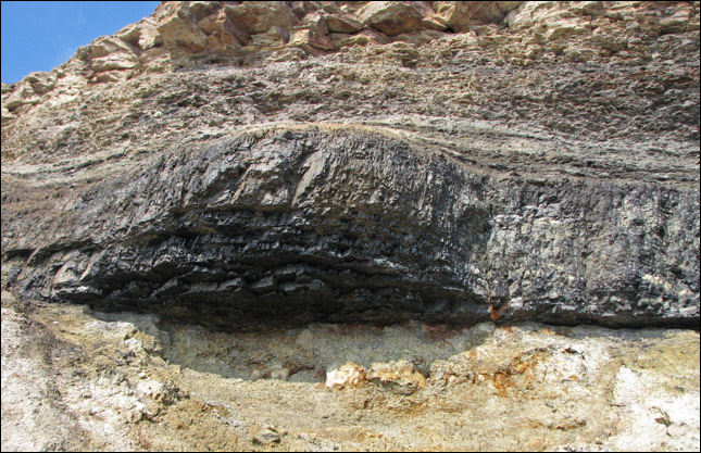
A great view of the coal seam.
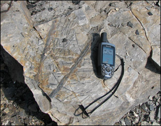
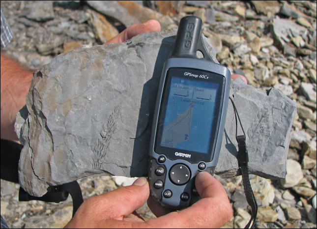
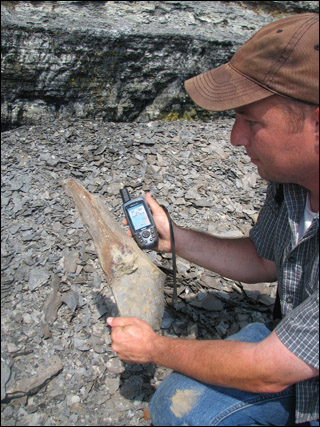
Plant based fossils (with the gps for scale).
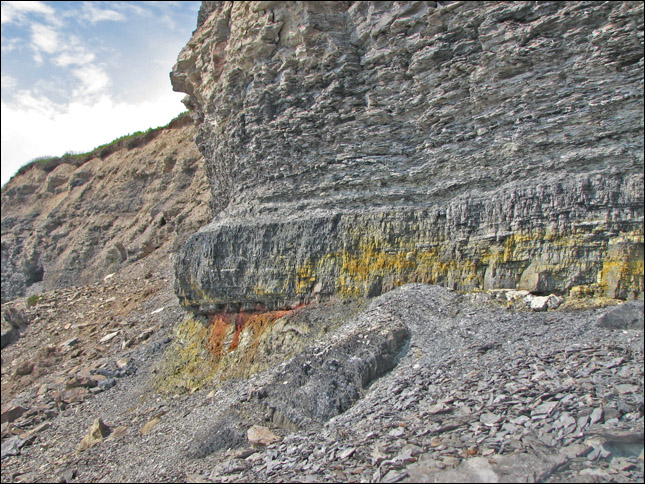
Close up of the Point Aconi seam showing both iron staining ( reddish brown ) and organic sulphur leachate ( yellowish ) along the lower areas of the seam. These are both contributors to acid mine water drainage into streams and rivers during and after mining, and sulphur emissions from the burning of coal causing acid rain.
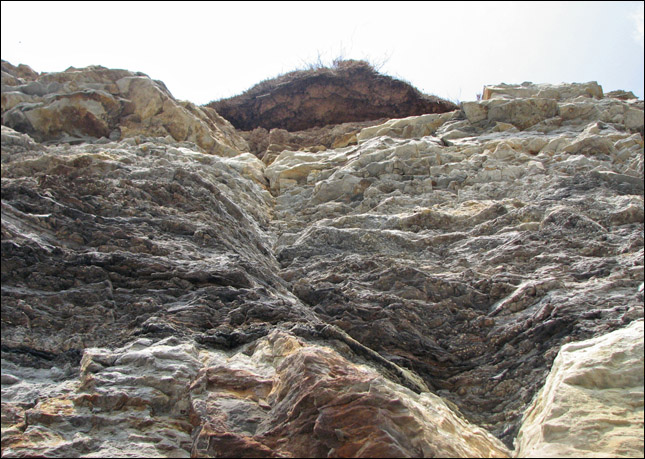
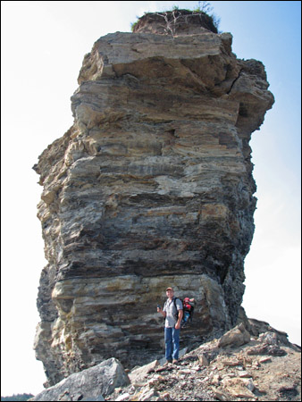
lookING up you can see how standing at the edge of the cliffs up top is not too safe!
Really great fern fossils.
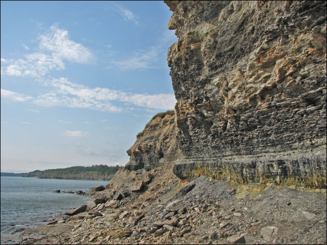
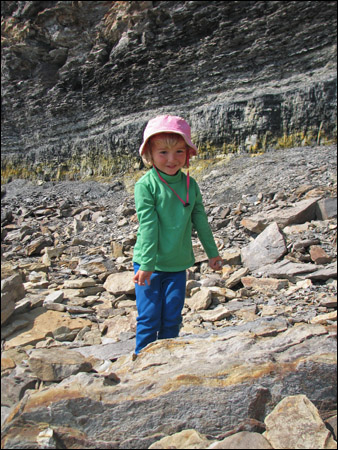
A closer look at the coal seam...
you can see all the rock shards heaped below which are a treasure trove of fossils.
Samantha is making her own collection of fossils.
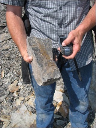
Rubby shows another couple of samples.
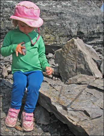
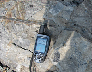
Samantha is sitting on a rock that has split in two...
you can see both the fossil and its impression on the 2 halves.
Rubby and Christopher at the base of the tip of Point Aconi.
Rounding the tip of the point, we can see the coal seam from the other side.
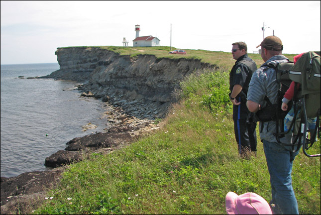
Taking the Sydney constable out for a geocaching lesson.
From the Cape Breton Coal Earthcache:
Coal (Old English and Middle England col): a compact, stratified combustible rock composed largely of chemically and physically altered plant remains ( carbon ) mixed with a variable amount of inorganic material along with assorted other elements, including sulphur. Often associated with the Industrial Revolution, coal remains an enormously important fuel. It is the largest single source of fuel for the generation of electricity world-wide, and a vital component in the reduction of iron ore.
Coal is the result of a process that begins with the formation of peat. Peat is formed by an accumulation of plant material in swamps with a high water table and poor drainage. In this environment, stagnating groundwater covers the dead plant debris, preventing significant decomposition. As the peat accumulates, it becomes compacted, largely due to loss of water. Between seven and twenty-seven metres of peat are required to form a one-metre layer of bituminous coal which may represent the accumulation of plant debris over 6,000-9,000 years. The major coal seams of Nova Scotia were formed in the Late Carboniferous period approximately 300 million years ago ( that is 300,000,000 years ago ). The flora then was predominantly primitive spore -bearing plants although some early seed-producing plants also existed. The plant types which flourished and accumulated to form peat in these locations varied according to their environment. Factors within the swamp such as oxygen supply and bacterial activity affected the peat formation. Inorganic sediments (clay, silt and sand) were carried by streams and by wind into the peat swamps, particularly near their margins. These and other factors determined the nature of the coal seams mined today in Nova Scotia, especially their ash (inorganic matter) and sulphur content Peat formation was usually halted by an environmental change such as a sudden shift (avulsion) in the position of a river or an increased rate of basin subsidence. If the peat was not eroded but buried under sediments such as mud and sand, it would be preserved to undergo the process of coalification. In many cases, plants which flourished in the peat swamp when it was buried by inorganic sediments have been preserved as delicate fossils in overlying (roof) mudstones and shales, or even as upright trees in mudstones and sandstones. Through time and with the increasing pressure of overlying sediments, the peat was transformed to coal through this process of coalification. This process is a gradual change from peat through lignite (brown coal), sub-bituminous coal, bituminous (black) coal, semi- anthracite.
The Sydney coalfield contains the largest coal reserve in eastern Canada. The approximately two-thousand-metre-thick coal-bearing Morien Group underlies a roughly triangular area with an apex south of Sydney and a base off the south coast of Newfoundland. More than 98 percent of the coalfield is submarine although eleven of the thirteen known major coal seams outcrop on land. The coal seams dip gently approximately 5° toward the deeper offshore basin centre except where affected by the northeast-trending open flexures. Even on the flanks of these folds, dips rarely exceed 15°. The fact that seams tend to be somewhat thicker in the synclines than over the anticlines suggests that these structures are at least in part contemporaneous with deposition of coal. The rank of the Sydney coals varies considerably, increasing to the east and with depth. They are classified generally as high volatile A bituminous but in places reach medium volatile bituminous.
The mining of coal has been a major factor in the industrial and social development of the Province of Nova Scotia. Nicholas Denys, governor of Nova Scotia, stated in dispatches to France in 1673 that there was "a mountain of very good coal four leagues up Spanish River," near Cow Bay, Cape Breton Island. By 1720, a mining operation had been initiated to supply the French fortress Louisbourg. The first officially recorded export of minerals from Canada occurred in 1724 when a shipment of coal was exported from Cape Breton to Boston.
The Prince Mine was located in Point Aconi, Cape Breton County. The mine began underground production from the Hub Seam in 1975, initially using room and pillar methods. Mechanized retreat longwall operations began in 1980. After producing approx. 25,000,000 tons of coal, it was closed in 2002. This was the last of the major producing collieries in Cape Breton. Below is the mine plane showing the workings. The Hub Seam is approx. 150 metres below the Point Aconi Seam.
[ back ]