Maritimes - Summer 2008
July 5 - 25, 2008
Day 20 - july 24
mactaquac, fredericton & earth caches
Eolian Sand Dune & Howland Falls
The New Brunswick glacial desert earthcache turned out to be one of the less impressive earth caches. The focus of the cache was a bunch of eolian dunes near the airport. After having seen lots of sand dunes on our trip, Samantha was a little puzzled why there were dunes here but no beach. *grin*
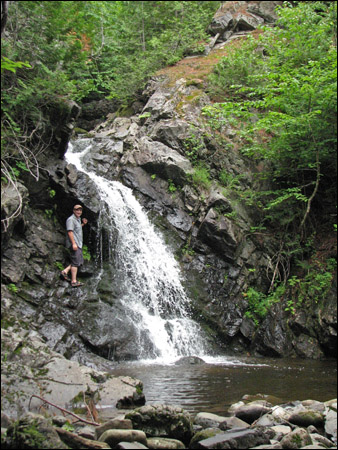
On the other hand, we always love seeing waterfalls and Howland Falls did not disappoint. On the way down to it we had fun spotting all the different mushrooms... sure wish we knew what kinds they were and whether they were edible! Rubby had fun climbing around a bit and found a convenient rock that showed how water had been shaping the rock and wearing away at it so that Samantha could also appreciate the lesson of this earthcache.
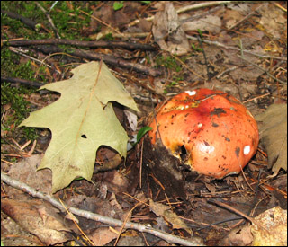
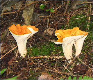
Lots of different mushrooms along the path to Howland Falls.
Rubby at the falls.
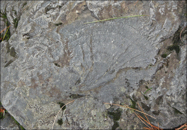
Interesting patterns on the rocks.
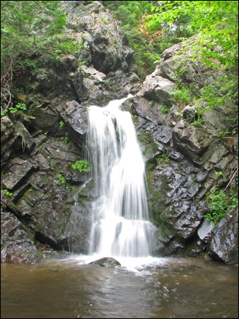
Howland Falls.
From the New Brunswick glacial desert Earthcache description:
"This earthcache brings you to another unique roadside formation that you may have driven by many times before and looked but never wonder why. These are eolian dunes formed near the end of the most recent ice age.
The story of this area begins with the glacial retreat. The last glacial episode in New Brunswick began about 25,000 years ago, when the Laurentide ice sheet moved south overspreading New England and Eastern Canada. During its peak development, this ice sheet was centered over eastern Canada and flowed east to southeast across New Brunswick into the sea. The ice itself was thousands of feet thick, with its massive weight shaped the land as it slowly traveled. Climatic warming forced the Laurentide ice sheet to stop and begin to recede as early as 21,000 years ago. This melting of the ice sheet released more water then is possible to imagine.
As the retreating glacier halted for a time the margin would stabilized, thickened as it did in the rolling hills northeast of Fredericton. Here the rushing water carried with it whatever the glacier had picked up along its travels dumping it into the ocean. While it is now far from the ocean’s edge, this area was once depressed by some 400-500 feet as a result of the Earth's adjustment to the tremendous mass of the Laurentide ice sheet that had covered the area. In the area of this earthcache the very fine materials finally settled out as the water slowed. By 8000 years ago the earth had rebounded from its compression and the river valley became dry.
These very fine sand grains were pushed around by the winds in the area. The lack of trees shortly after the valley dried up allowed the formation of these eolian dunes. Once the plants and trees began to grow the area was stabilized and the eolian dunes remain today a part of our glacial past. This was an ideal location to build an airport because the amount of building materials on location. All they had to do was remove the trees and smooth the eolian dunes and you have an airport ready to go. The few eolian dunes that were not destroyed to make the airport and are still left are now along the side of the road."
From the Howland Falls earthcache description:
"This earthcache brings you to a well-known local waterfall located on Sinnots Brook. This falls has some very unique geology and has water falling in all seasons.
The most recent glacial episode in New Brunswick began about 25,000 years ago, when the Laurentide ice sheet overspread New England and Eastern Canada.
During its peak development, this ice sheet was centered over eastern Canada and flowed east to southeast across New Brunswick. It became several thousand feet thick, while its massive weight shaped the land as it traveled.
Climatic warming forced the Laurentide ice sheet to start receding as early as 21,000 years ago. This melting of the ice sheet left a great deal of evidence behind. The last remnants of glacial ice probably were gone from New Brunswick by 10,000 years ago.
The rapid melting of the glacier released great quantities of water that quickly eroded the land leaving deep-sided valley as the water rushed to the ocean.
In the area of Howland Fall the Sinnots Brook cut a deep valley through the glacial till until it hit a volcanic intrusion. As the water slowly cut down the harder road the softer materials below were eroded more quickly. It is this erosion below the volcanic rock that has formed the waterfalls.
If you go to the bridge you will see how the valley changes just before the falls becoming narrower with large rock outcrops on either side of the stream. While the harder rock is not very wide it does form a natural dam with a beautiful free falling waterfall.
When you approach the falls from the bottom you will discover the same hard rock.
It is also interesting to return by walking up the other side of the falls. While it is much steeper it does bring you across the harder rock with an interesting view of the cross section of how the water forced its way through the rock."
[ back ]