Maritimes - Summer 2008
July 5 - 25, 2008
Day 21 - july 25
plaster rock & home
Glacial erratics, landslides and sinkholes
The "Which way did it travel" was a quick lesson on glacial erratics. Basically we were to examine some rocks along the road for signs which would indicate the direction the glaciers once travelled in this area.
At the "Slip Sliding Away" earthcache we got to about 100m from the posted coordinates and decided that Rubby would finish the trek himself due to a tough bushwhack for the kids.
Our last cache was the "Plaster Rock's Gypsum Karst" earthcache. This was the last cache of our trip and we made the detour from the Trans Canada to Plaster Rock just to get this one. It was absolutely pouring rain but Rubby got out to check the sink hole. Then we headed into town for a very late lunch at a local pizza place.
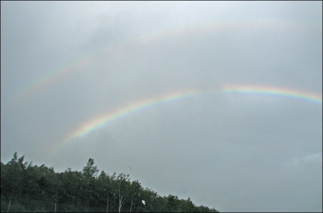
We knew the weather would hold once this rainbow turned into a double rainbow!
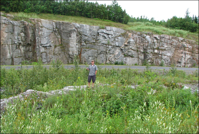
Rubby trying to figure out which way the glaciers travelled from marks on the rocks.
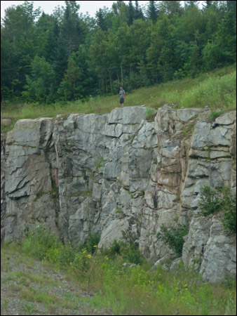
Rubby examining the rocks at the top of the cliff.
The lines in the rock indicate the direction, but was it an advance or a retreat?
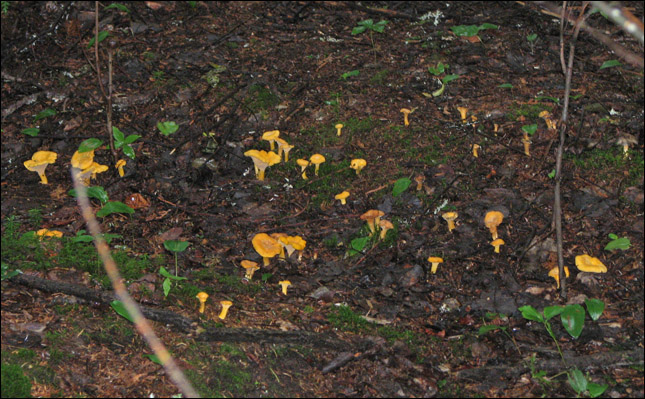
A huge patch of chanterelles.

In the meantime Rubby found 2 pairs of boots sitting neatly in the forest. ?!

Rubby finds more chanterelles and diligently waymarks them in the gps for future reference.

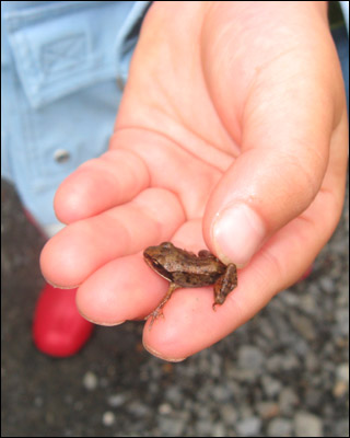
Samantha found a couple of little baby wood frogs along the path.
Samantha snacks on some raspberries while we wait for Rubby.
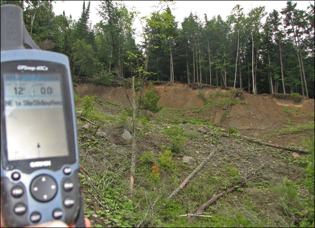
The object of the cache: this landslide.
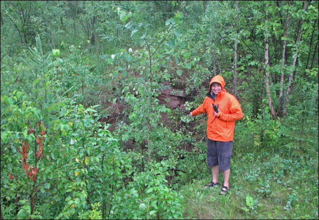
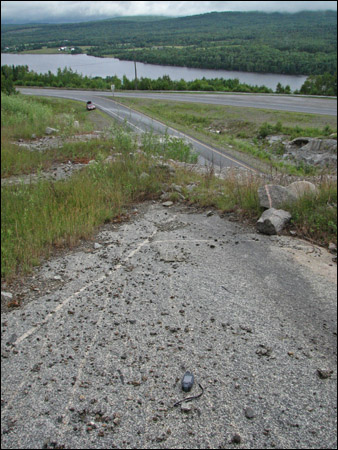
Just a quick photo of Rubby in the pouring rain with the Plaster Rock sink hole.
From the "which way did it travel" earthcache description:
"The most recent glacial episode in New Brunswick began about 25,000 years ago, when the Laurentide ice sheet overspread New England and Eastern Canada. During its peak development, this ice sheet was centered over eastern Canada and flowed east to southeast across New Brunswick. It became several thousand feet thick, while its massive weight shaped the land as it traveled. Climatic warming forced the Laurentide ice sheet to start receding as early as 21,000 years ago. This melting of the ice sheet left a great deal of evidence behind. The last remnants of glacial ice probably were gone from Maine by 10,000 years ago.
This EarthCache will show you how geologist can look at the land to understand the past. It will give you a new perspective of the land. It will explain a ten-mile trip along the Trans Canada Highway in west central New Brunswick. To best understand this EarthCache you must travel the highway in both directions over this section but need to only travel west bound to complete the cache. The description is going east then returning west because in this section of the road that is the direction that the glacier traveled. As you travel south from Woodstock, east on the Trans Canada Highway, the land is gently rolling composed of relatively soft rock. But as you drive several miles east of Canterbury the land suddenly rises very quickly. This is the edge of the Pokiok Batholith, a very hard course grained granite that was formed during the Early Devonian period deep underground. The rock is easily identified due to the very large grain of the granite. This formation is not a very large one so it will show the movement of the glacier very well. Up until this point in your trip there have been few large rocks and the land has been rolling. But as the glacier moved up and over the harder rock sections of the rock sections near the surface were torn from the bedrock. These sections were broken and tumbled by the glacier as they moved along. As you continue the trip toward Nackawic you will see a great number of these broken sections called erratics all along the road. As you return you will look at them as their number and size changes over the distance you travel.
Boulders that differ from the bedrock beneath are call erratics. He word erratic comes from the old French “erratique” which is derived from the Latin “errare” meaning "to wander." An erratic is a piece of rock that has been eroded and transported by a glacier to a different area; it is left behind when the ice melts, simply dropped in place. Glacial erratics give us information about the direction of ice movement and distances of transport. Glacial erratics can be any size from small pebbles to large boulders the size of a house. This area is a classical example of the type of boulders that were carried here by the glacier and dropped when it melted.
Most glacial erratics appear worn and rounded, and sometimes include beveled or faceted surfaces. During the course of their journey, the rocks were jostled against other erratics or scraped against the underlying bedrock, rounding off corners and planing smooth surfaces, eventually producing their characteristic appearance. Glacial transport also caused some boulders to fracture, producing fresh angular edges.
The composition of glacial erratics can often lead to identification of their point of origin and thereby provide some specific information about the direction of ice movement. At times, a string of erratics of similar composition can be observed across a broad region. These are referred to as "boulder trains," and are defined as a series of erratics that have come from the same bedrock source, usually with some special characteristic that makes it easy to recognize their common origin. Boulder trains appear as long lines or fans of erratics extending outward from their source in the direction of ice flow. Erratics from a given area are nearly always more numerous near their source and diminish in number with distance from the source.
At the posted coordinates you will find a road cut that shows a great deal of evidence about the direction the glacier traveled. The top of this outcrop of rock is what is called a Glacial Pavement. This is a rock surface that has been scraped by glaciers moving over it. Rock fragments frozen into the base of the ice scratched the underlying rock. These scratches are called striations if they are small and grooves if they are large. Scientists use these features to show the direction of ice movement."
From the "Slip Sliding Away...." earthcache description:
"Landslides in North America cause approximately $5 billion dollars per year in damage, and kill between 40 and 75 people annually. The casualties are primarily caused by rockfalls, rock slides, and debris flows.
[...]
Some slopes are susceptible to landslides, whereas others are more stable. Many factors contribute to the instability of slopes, but the main controlling factors are the nature of the underlying bedrock and soil, the configuration of the slope, the geometry of the slope, and ground-water conditions. Once a landslide is triggered, material is transported by various mechanisms including sliding, flowing, and falling. Landslides often occur along planes of weakness that may parallel the hill slope. Soils such as silt and clay are weaker than rock and commonly have complex or multiple planes of weakness. Landslides occur in slopes oversteepened by the process of stream erosion or by the activities of man in grading slopes. In many instances oversteepened slopes stand in apparent stability until abnormally high ground-water conditions occur, thus reducing the shear resistance and triggering the landslide. Once a slope in a sensitive soil has been oversteepened by erosion at the toe or by excavation work and the ground-water table is high, the stage is set for a landslide to occur.
Three distinct physical events occur during a landslide: the initial slope failure, the subsequent transport, and the final deposition of the slide materials. Landslides can be triggered by gradual processes such as weathering or by external mechanisms or even a combination of factors. This type of slide is called a rotational slide. Where the surface of rupture is curved concavely upward and the slide movement is roughly rotational about an axis that is parallel to the ground surface and transverse across the slide. It was caused by a combination of factor going back to the last ice age where as it retreated it left a fine layer of clay that covered the region. The fact that the water was high for several years cause the gradual undercutting of the river bank which when coupled with heavy spring rainfall and run off cause the bank to fail. The area above the slide had been recently logged which changed the general nature of the spring run off. The heavy rainfall induced increased erosion and oversteepening of the slope. Besides this, the increased rainfall raised the water table, which increased the pore water pressure, which in turn reduced the shear resistance in the glacial marine clay causing it to liquefy and finally slide."
From the "Plaster Rock's Gypsum Karst" earthcache description:
"This earthcache will bring you to a roadside sinkhole. Not just any sinkhole but one people have been doing battle with for a number of years.
Plaster Rock is another name for gypsum and the bedrock under this area is all gypsum without any caps rock. There is an extremely high concentration of sinks in this area, 500-800 per square mile. Sinks or sinkholes, also known as doline (in the Slovene language dolina means valleys), are formed by the collapse of cave roofs and are a feature of landscapes that are based on gypsum or limestone bedrock. The result is a depression in the surface topography. This may range anywhere from a small, gentle earth-lined depression, to a large, cliff-lined chasm. Most often there is a small area of rock exposure near or at the bottom of a sinkhole, and a patent opening into the cave below may or may not be visible. Sinkholes are usually but not always linked with a karst landscape. Karst represents a set of surface features that are characteristic of gypsum or limestone under the soil. In many such regions, there may be hundreds or even thousands of sinkholes in a small area so that the surface as seen from the air looks pockmarked. Often in such areas there are few or no flowing streams on the surface because the drainage is all sub-surface.
Sadly, sinkholes have for centuries been used as disposal sites for various forms of waste. If you look closely at the sink on the edge of the highway you will see that local people have in the past used it for that very purpose. I have watched this sink over the years as it has changed shape and grown. Even to my surprise I checked it out to find that it had been filled with gravels just to return a few weeks later to find it open once again.
If you walk to the top of the road cut and look south you will see several more sinkholes. Also in the road cut it self you will find several smaller sinkholes. About 500 meters to the south you will find an abandoned airport. This airport was made and quickly abandon due to the rapid formation a sinkholes in its surface."
[ back ]