Fundy National Park
May 21-25, 2010
chaudière falls
earthcache description:
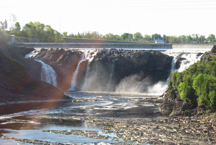
"This fall has a 35-metre height (115 feets). Its annual medium flow is 114 m³/s, varying from 11 m³/s (low water) to 470 m³/s (spring high water), with historical maximum of 1760 m³/s. The Chaudière River (French for "Cauldron" or "Boiler River") is a 185 km (115 miles) long river rising in Lac-Mégantic, in southeast Quebec, Canada. The falls have been harnessed for hydro-electric power since the beginning of the 20th century. The dam was rebuilt in 1999 on the remains of the old installations, and now consists of a small 24 MW power station.
Why there is a fall in this place?
Before answering this question, you must know that the end of the river is on the Sillery formation. This formation is represented by loamy stratum. There are occasionally stratum of sandstone. Schists have a very weak hardness and are very sensitive to erosion. Sandstones have a variable hardness, as a result some can be resistant to erosion. Therefore, the river slowly dug a canyon in schists until instant or the threshold of fall arrived on a bench of more resistant sandstone.
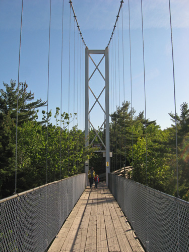
Interesting fact: There is a splendid footbridge of more than 100 metres long above the river.
Why this river overflows often in spring? There are several reasons. The river's drainage area is 6682 square kilometers. But, the main reason is that the river runs northward, what causes that the mouth thaw in last."
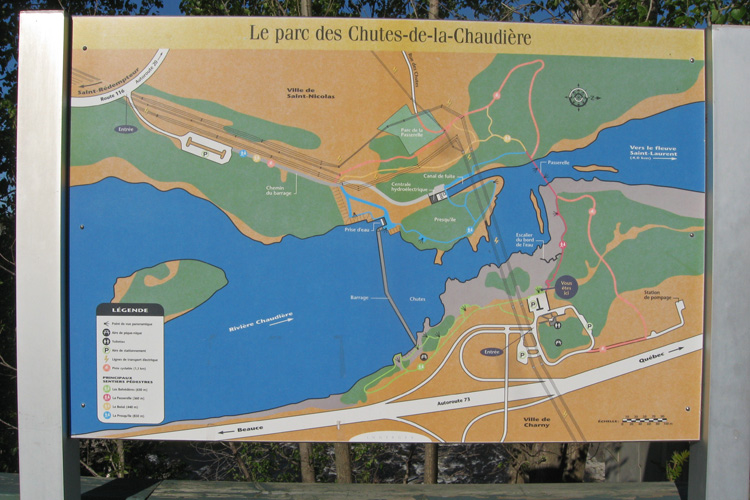
the map of "le parc des chutes-de-la-chaudière"
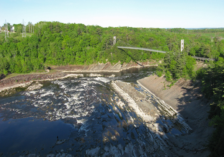
a view towards the bridge we want to head to.
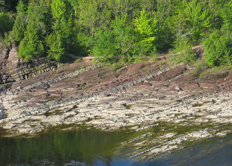
interesting rocks.
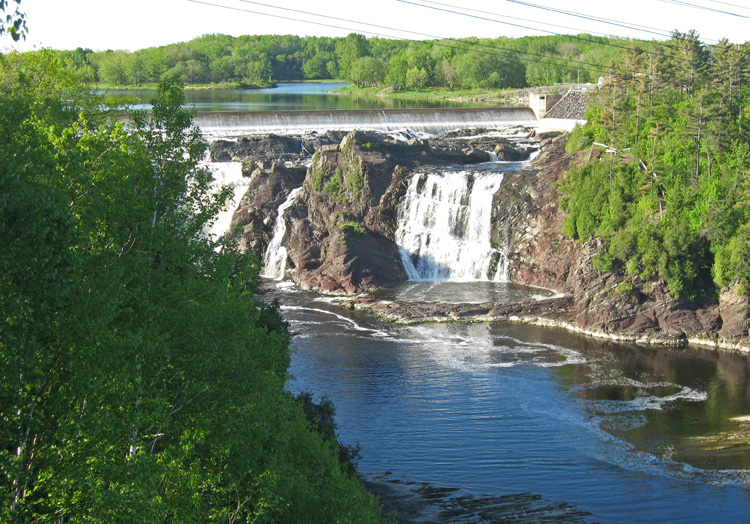
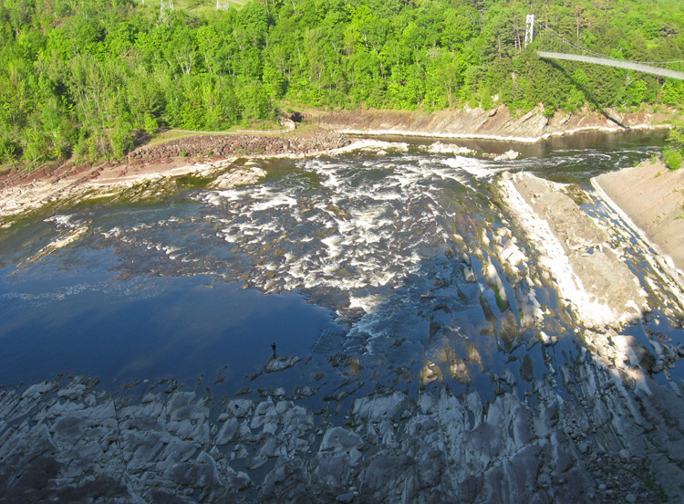
we start to see the falls.
someone getting a ground level view.
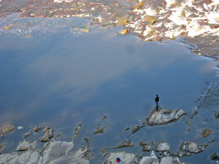
he looks like he is enjoying the peacefulness of the area
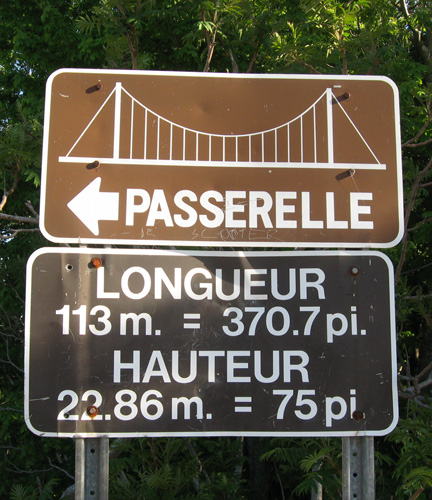
to the passerelle!
oh no... first we need to pay a toll!
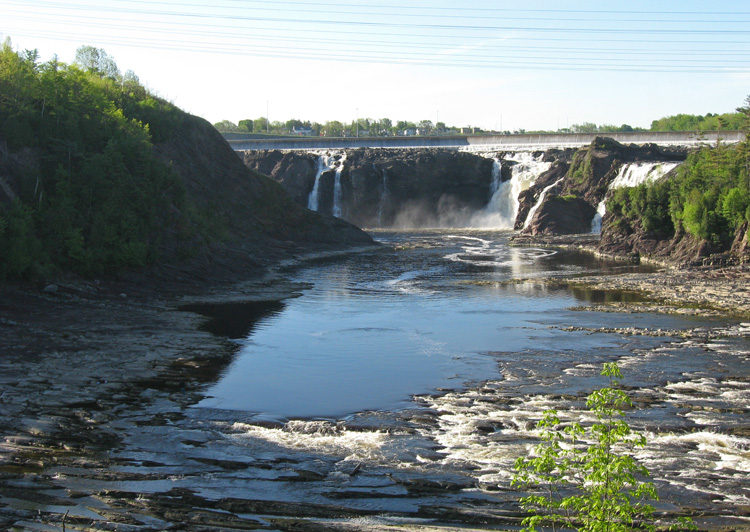
quite a nice view.
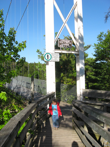
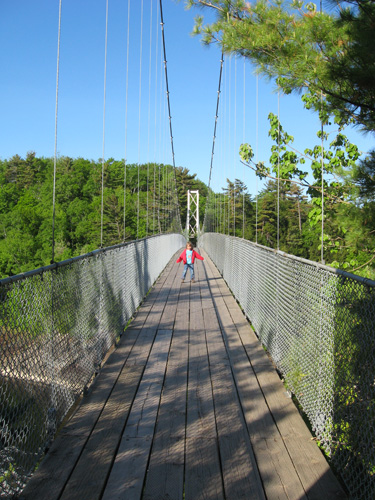
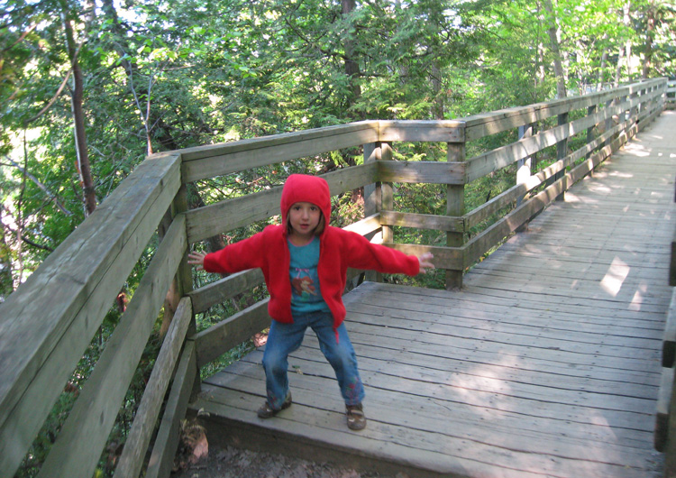
sam enjoyed the "passerelle"
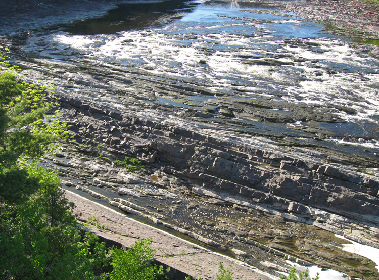
more interesting rock layers.
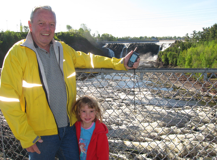
fulfilling our earthcache photo requirements.
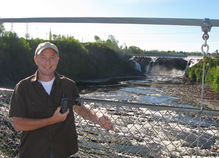
...and my turn too.
looks like a nice place to take a shower.
we head back towards the car.
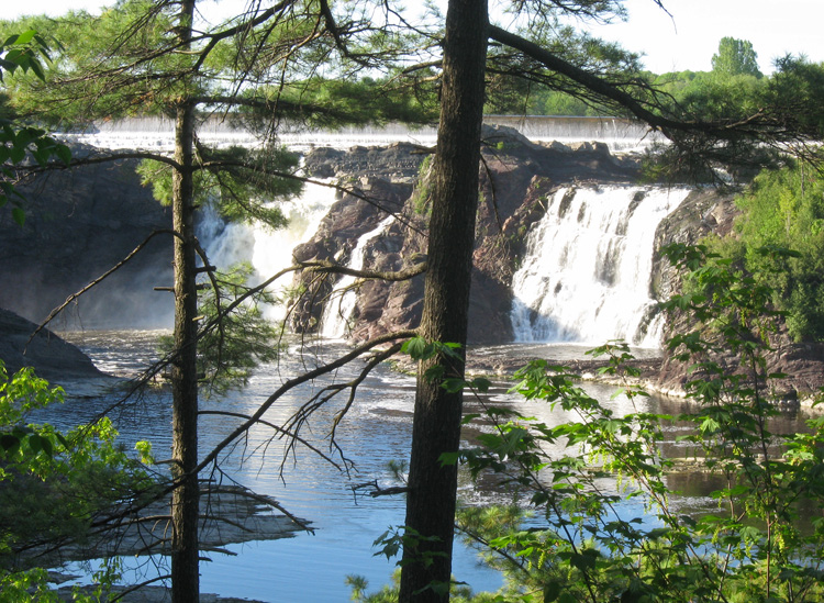
a view through the trees.
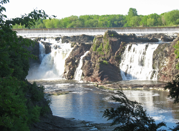
quite impressive.
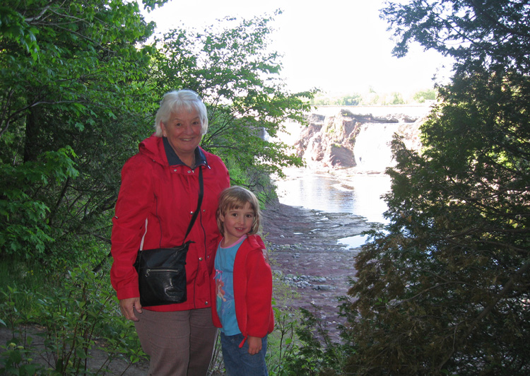
grandma & sam with the falls in the background
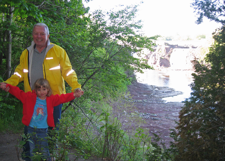
grandpa & sam with the falls in the background
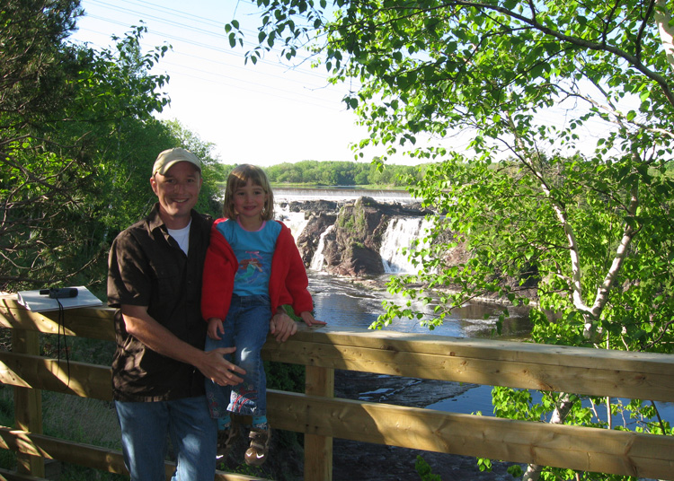
poppa & sam with the falls in the background
next: stratum (earthcache) »
menu earthcache: supper at suzanne & roland's place
|