Fundy National Park
May 21-25, 2010
stratum (earthcache)
earthcache description:
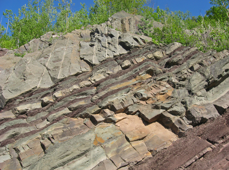
"If you look northward, you will see a splendid rocky wall. Thanks to the building of roads, several geological phenomena are put in day. This wall has layers of many colors and an interesting incline.
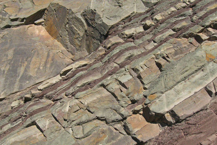
On this wall, they see a succession of layer of different colours. These layers tipped up in comparison with the skyline. We call these layers: stratum. In geology and related fields, a stratum (plural: strata) is a layer of rock or soil with internally consistent characteristics that distinguishes it from contiguous layers. Each layer is generally one of a number of parallel layers that lie one upon another, laid down by natural forces. They may extend over hundreds of thousands of square kilometers of the Earth's surface. Strata are typically seen as bands of different colored or differently structured material exposed in cliffs, road cuts, quarries, and river banks. Individual bands may vary in thickness from a few millimeters to a kilometer or more. Each band represents a specific mode of deposition -- river silt, beach sand, coal swamp, sand dune, lava bed, etc.
Geologists study rock strata and categorize them by the material in the beds. Each distinct layer is usually assigned to a "formation" name usually based on a town, river, mountain, or region where the formation is exposed and available for study. For example, the Burgess Shale is a thick exposure of dark, occasionally fossiliferous, shale exposed high in the Canadian Rockies near Burgess Pass. This one is called : Sillery formation. Slight distinctions in material in a formation may be described as "members" or sometimes "beds." Formations are collected into "groups." Groups may be collected into "supergroups."
The stratum is the fundamental unit in a stratigraphic column and forms the basis of the study of stratigraphy.
On this wall they can easily see shale strata and sandstones strata, more resistant. Shale are characterized by thin laminae breaking with an irregular curving fracture. It is because of a movement of the earth's crust northward, that strata is tipped up."
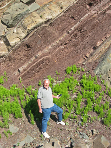
mandatory photo for the earthcache
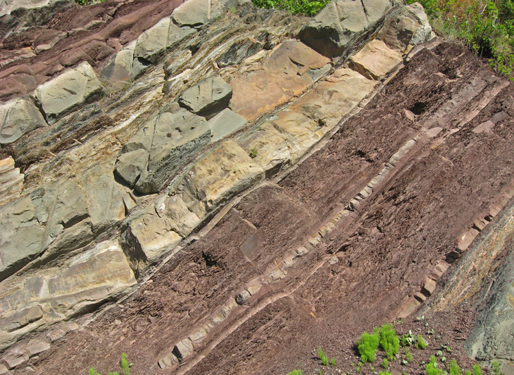
lots of layers of rocks...
... different types, colours, thicknesses, etc...
my turn to smile!
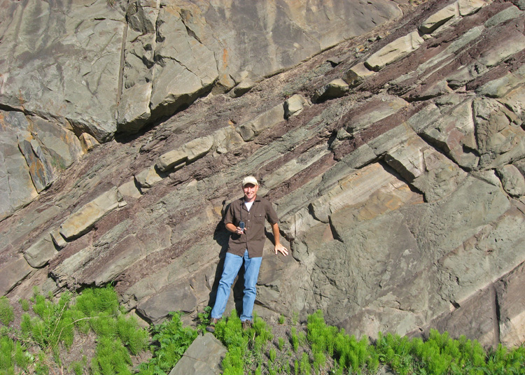
on last view of the rocks
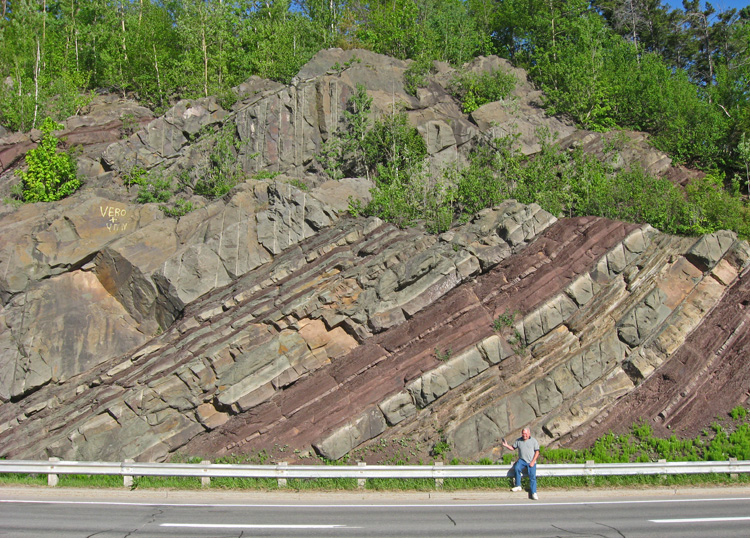
i ran across the street to get an overview shot of the outcrop.
one police arrived at the appartment complexe we parked at and it looks like another one is on it's way.
we didn't stick around to find out what was going on.
next: olistostrome (earthcache) »
menu earthcache: supper at suzanne & roland's place
|