Iceland: Day 16 - Skaftafell National Park
July 10, 2004
This morning we were awakened by a little bird perched on our tent. We checked out the visitor center and had a guided tour to the glacier tongue at 10am. Following a salami sandwich lunch, we took another guided hike with the same guide... this time to an old farm called Sel on the slopes of the mountain. The following is some of the information we gleaned from our guide:
Skaftafell Flora
- Lady's bedstraw - used in pillows for its pretty scent
- River beauty - often found in dried up river beds, this pretty flower puts nitrogen into the soil
- Pyramidal saxifrage - also known as "the rock breaker"
- The juniper - the only evergreen endemic to Iceland
- Wooly willow - common tree
- Tea leaf willow - can be used for aspirin
- Crowberry - edible (but not very tasty)
- Sea pea - edible
- Orchids - in Icelandic, all orchid names have something to do with fertility
- Garden angelica - to eat and to make medicines
- Cumin and arctic thyme - some of the herbs and spices found naturally.
- Another plant was pointed out to us but we didn't catch the name - drops of water collect on its leaves and these make great tea
Geology
Along the edge of a glacier tongue you can find little hills that are called glacier kettles. These result from broken off icebergs, often with quicksand on top. In Skaftafell, you also find many boulders of soft rhyolite stones from a mountain 6 km away which get broken apart by frost. The grey streaks on glacier are moraines, rocks that fall from mountains higher up and travel out to the tongues.
Skeiðarársandur is a sandy area along the southern part of Vatnajökull. Is is crossed by a network of ever-shifting glacial rivers, which create such an obstacle to road building that the bridges to complete the Ringroad around Iceland were only completed in 1975. Before that, anyone living to the east had to travel to Reykjavík via Akureyri or inland roads. These bridges had to be designed to cope with regular jokulhaups from Vatnajokull which carry tonnes of boulders, gravel, ice and water. One cause of these is Grænalón, a lake formed on the glacier that every few years overflows and empties.
Even more destructive are several active volcanos such which cause pressure that lifts the ice cap and also cause ice to melt. Every 10 years or so, such geological activity at Grímvsvotn, results in jokulhaups in the Skaftafell area. In 1996 a force-five earthquake signalled the oncome of a 10 day volcanic eruption that blew steam, ash and smoke 6km into the sky. The melted ice had collected in Grímvsvotn and when it suddenly burst, a 5m wall of water spewed across Skeiðarársandur sweeping away 7km of road and demolishing or damaging several bridges despite their hardy construction. Within 14 hours the flood rate peaked at 45,000 cubi metres per second.
From further up the mountain we got a good glimpse of the dykes that have been build to direct the floodwaters from Grímsvotn and major floods generally happen every 10 years or so. The guide told us that recent earthquake tremors indicate such a flood might happen this year but that everyone was hoping it would wait until after July 17th, the 30th anniversary of the bridge which was the final part of the the circle of the Ringroad. We also saw the remains of one of the bridges that perished in an earlier flood.
Incidentally, the volcanic eruptions and floods finally happened in October/November 2004 but no major damage seems to have been reported.
The Sel Farm
"Sel" means a winter house for sheep.
Originally the farm buildings were positioned down near the campsite. With the encroachment of the river Skeiðará acres of fields disappeared under layers of sand and gravel and during the years between 1830-1850, the farm was relocated about 100 metres higher up on the hillside. The present farmhouse dates from the 1920's. Sel was abandoned in 1946, and is now in the custody of the National Museum.
Along the way we saw the power station for the farm which can generate up to 3.1 kwatts. The water pipes were all made from driftwood. The guide told us that the station provided electricity for 2 farms owned by 2 brothers but since it was on the property of the one brother, he would sometimes cut the other off if they got into disputes. Behind the station is the Thieves' waterfall which is said to have a tunnel behind it for thieves to escape up into hills.
We toured the farm and say the winter kitchen in which sheep dung was used for firewood - if smoke rises then it's a sign of good weather ahead, if smoke stays under roof, then rain will come.
Lambhagi
Lambhagi ("lamb's meadow") is where lambs were kept while the sheep were milked.
This is the one area left that still has many non-Icelandic trees left and they are some of the tallest in Iceland. We didn't see any lambs, but we did see some trout in the stream.
We also saw a nameless waterfall where two anchors from a dutch "gold" ship were buried. Actually, the cargo was worth x amount of gold but people started to refer to the cargo itself as gold. Years ago farmers wanted to use the iron from the anchors but it was buried too deep to get out.
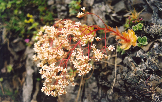
Pyramidal saxifrage (Saxifraga cotyledon).
The icelandic name Klettafrú means Lady of the Rock.
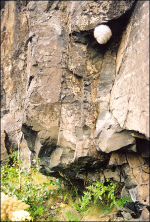
What first looked like a cool rock, turned out to be some sort of bee or wasp nest.
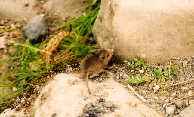
A little field mouse, one of the few mammals of Iceland.
The restored powerstation that used to power the Sel farms.
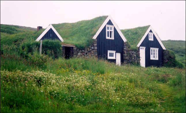
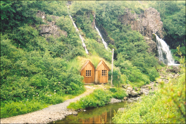
The Sel farm house with turf roofs.
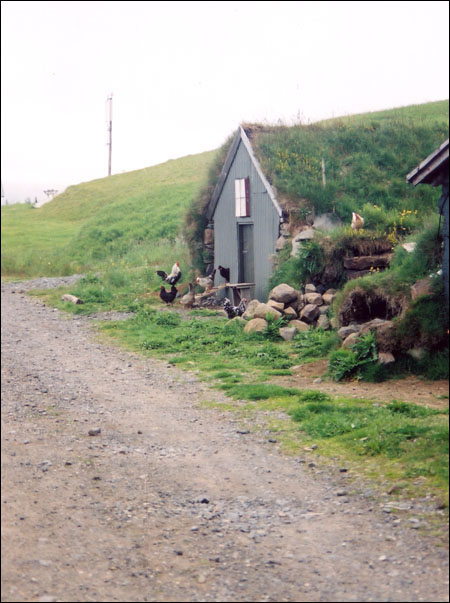
Iceland has its own special breed of chickens.
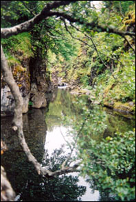
Lambghi - This little idyllic spot was used to keep the lambs while the adult sheep were being milked. In the clear waters we saw trout.
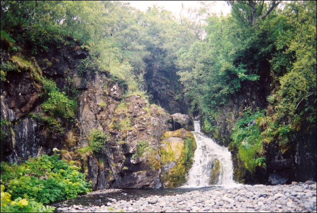
By this waterfall is the site of the anchors from the "gold" ship.
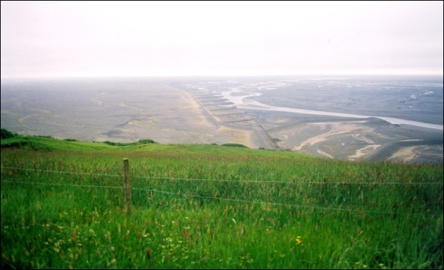
An immense system of dykes has been set up for the huge jokulhaups (glacier floods) that come every few years.
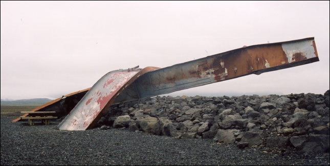
A picnic spot by a leftover piece of bridge from the last big jokulhaup.
[ Iceland Vacation Home Page ]