Iceland: Day 22 - Háifoss
July 16, 2004
First thing in the morning we tried to find Hagrifoss but we were unsuccessful either because we got lost between the map and all the new roads being built, or the waterfall is no more thanks to the dam further upstream. The second explanation seemed more likely as many hydroelectric power stations have been built to harness the Þjórsá river and its tributaries.
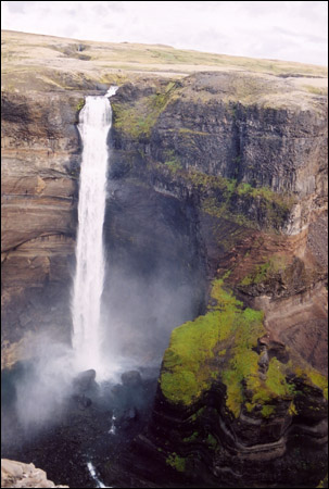
So back to trying to find Háifoss which at 122m is the second highest waterfall in Iceland. For being such a beautiful waterfall it was not well marked at all and even with specific instructions from a local, the super bumpy road did not look very promising. We almost decided to turn back when we parked at the side of the 'road' and decided to take a short walk where we finally found the parking lot for the little trail along the top of a ravine. I decided to actually climb down the ravine to get the view from the bottom.
As we headed south and back towards the ring road we passed by Mt. Hekla, Iceland's most famous volcano. It is still very active, erupting most recently in 1970, 1980, 1981 and 1991. For centuries, Hekla was thought to be the gateway to Hell. We decided to stop long enough to gather pumice specimens... more rocks, but Rubby had to admit these wouldn't way us down too much!

We didn't find Hagrifoss but we got a beautiful view of Mt Hekla across the lake.
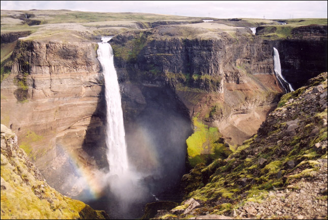
A beautiful view of Háifoss - a double waterfall with double rainbows!
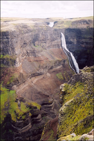
From the road in the distance, you don't even see this giant ravine with the waterfalls plunging into it.
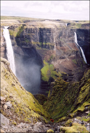
... while Rubby takes the adventurous route down below!
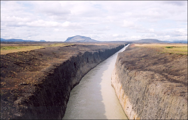
A canal for a hydro-electric station - impressive, but not very pretty.
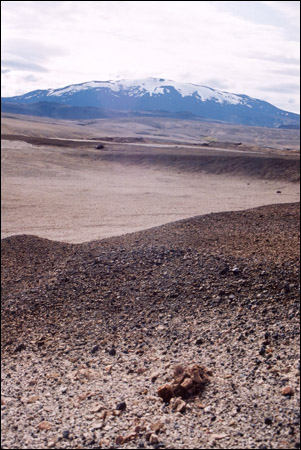
Pumice and volcanic ash cover the lands all around Mt. Hekla.
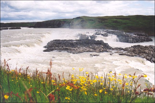
Urriðafoss ("Trout Falls") on the course of the Þjórsá river -
typical summer flow her is 350-700 cubic metres per sec.
[ Iceland Vacation Home Page ]